This is a panoramic view taken from the eastern boundary of the proposed site for the new Silsden School. Both of the green fields to the west (towards the houses) will be built on. At least 50% of the land will be concreted over.

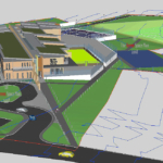
The site of the proposed new junior school – looking west from the eastern boundary. The two fields are divided by trees, not all the trees will be retained as the school will be built through the field boundary. The muddy area is where Yorkshire Electricity put the power lines underground (they were overland across the site). The eastern boundary is now a very wet area but and this is where the footpath will be re-aligned to. 3-D graphics are available which shows how the school will be positioned on these fields.


